We make spatial software that leaves your data with you: on your phone, on your desktop, or on servers your own organisation runs. Tavak collects surveys offline on Android. Homestead opens them on the desktop, along with whatever else you already have. Open formats throughout, so nothing is locked in.
Tavak collects. Homestead gets the ground ready beforehand and reads the results afterwards. What passes between them is an ordinary file you can copy, and neither app needs the other to be worth having.
Install it and start surveying. Nothing needs setting up on a desk first, and what you export is a GeoPackage with a QGIS project beside it, which any GIS will open.
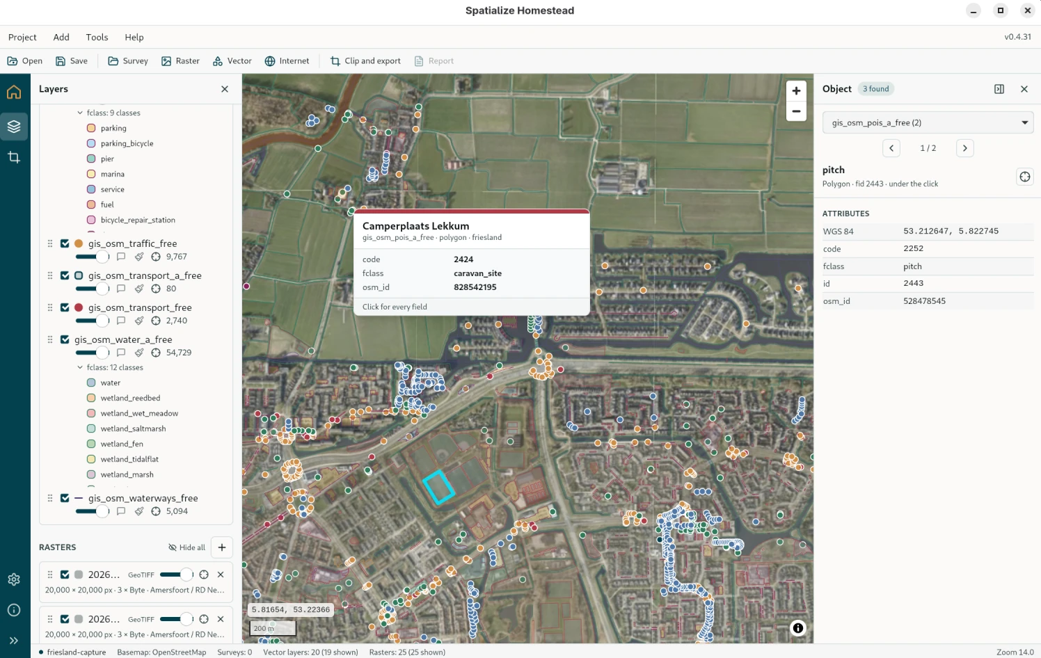
It started life as Tavak's companion and turned into a viewer and toolbox worth having on its own. Open any vector or raster file, style it, cut a piece out of it, convert it. You never have to touch Tavak.
A survey leaves the phone as a single ZIP; a basemap goes back as a single MBTiles. Both are open formats that any GIS reads. Put the files on your own machines, or on servers your organisation runs. There is nothing to migrate out of later.
One for the phone in your hand outdoors, one for the screen on your desk.
Offline GPS surveying that ends in QGIS.
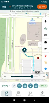
Record the track, draw points, lines and polygons into layers with your own forms, attach geotagged photos and videos, set geofences and destinations. Export a GeoPackage with the QGIS project already written. None of it needs a signal.
A map for what came back, and for everything else.
Open a survey backup with its photos, videos and replay. Or ignore Tavak altogether and load Shapefiles, GeoJSON, GeoPackages, GeoTIFFs and tile services, from disk or over the internet. Style them, colour them by a field, cut pieces out, turn rasters into MBTiles. Save the whole desk as a project.
Offline GPS surveying for Android. Install it, walk out, and come home with a survey any GIS can open.
Basemaps, GeoTIFFs and reference layers sit on the phone itself. Collect all day with no coverage, and export once you're back.
Geotagged photos and videos, either filed against the object they document through one of its form fields, or dropped on the map as a point in their own right.
Points, lines and polygons, with length, area and perimeter updating as you go. Average the GPS for a corner that has to be right, and snap to what is already on the map.
Every layer carries its own fields: text, numbers, choices, dates, ratings, photos and videos. Build the form once in the designer, or paste it in as CSV, then use it again on the next survey.
Satellite status across every constellation your phone can hear, signal strength, DOP figures, and an accuracy threshold you set yourself.
A GeoPackage with a QGIS project beside it: the layers already styled, the photos in the map tips. Shapefile, GeoJSON, KML, GPX and Excel too, in whichever coordinate system you need.
Homestead was built to be the desk between the field and the office: prepare basemaps and reference layers before a survey, then go through what came back afterwards, photos and videos and all, and replay the day. Along the way it became a viewer and toolbox in its own right. Open any vector or raster file, style it, cut a piece out, convert it, and keep the whole desk as a project. It's free, GDAL travels inside it, and there is nothing to install first.
Drop in the ZIP the phone exported. Layers, tracks, photos, videos and forms come up on the map straight out of the GeoPackage inside it, and a timeline plays the day back.
Shapefile, GeoJSON, KML, GPX, CSV, GeoPackage, File Geodatabase, from disk or straight off a URL. Millions of features pan smoothly, read from the file's own spatial index. No server anywhere.
Outline, fill, and point symbols from five icon fonts. Colour by a field, either its unique values or ranges, using any of thirty palettes, and the legend appears under the layer.
Draw a shape and cut whatever is on the map down to it: MBTiles for the phone, a Cloud Optimized GeoTIFF, or the vector layers gathered into one GeoPackage. It puts every core you have to work.
Save the desk as a .hstd file: what is open, how each layer is drawn, where the map is looking. Double-click it to pick up where you left off.
GDAL, PROJ and GEOS ship inside the package, so there is nothing to install first. No account, no telemetry. Free for anybody, and it stays that way.
Questions about the company, pilot projects, pricing or a partnership go to hello@spatialize.dev.
Already using Tavak or Homestead? Write to support@spatialize.dev, or start from the support links on each product page.