Looking things up
There are four ways to ask what is on the map: click it, rest the cursor on it, read the table, or search. The first two work on any layer. The table and the search belong to a survey.
Click: the object panel
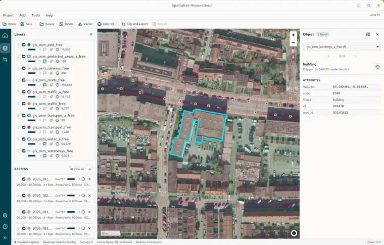
Clicking the map asks every visible vector layer what it has at that point, and opens the object panel on the right. At the top is a badge with the number of objects found, a Layer dropdown when more than one layer answered, and Previous and Next to work through the objects of the chosen layer, innermost first. The object's header names its geometry, its id and how far it is from the click, and the crosshair zooms to it. Under that come its media fields as thumbnails, then Attributes, starting with its position in WGS 84 and then every field that is not empty. Whichever object is showing is highlighted on the map in the colour from Settings › Map · object highlighter. Drag the panel's left edge to resize it, or use the arrow to collapse it to a strip that still shows the count.
In a survey: the identify popover
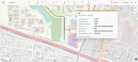
With a survey open, clicking its layers gets you a popover at the click point instead. If several objects are there you get a list; if only one, you get it straight away, with its title, the media it holds and its attributes. A second coordinate line gives the position in the survey's own coordinate system when that is not WGS 84. Open in attributes jumps to that row in the dock's Table tab, and Esc closes the popover.
Hover tips
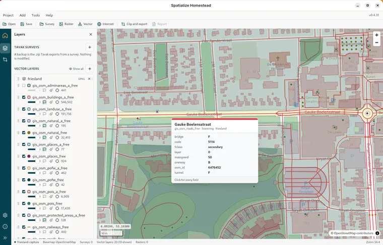
The speech-bubble button on a layer's row turns hover tips on for that layer. Rest the cursor on one of its features and a tip appears and follows it, carrying the name, the layer, up to fourteen fields, the location, and up to three thumbnails if the object holds photos or videos. It goes away when the cursor leaves, or when you drag the map.
The attribute table
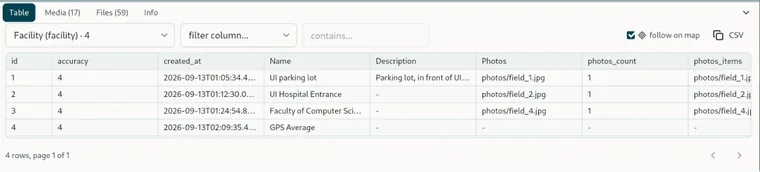
The dock's Table tab shows one table of the survey at a time, chosen from the dropdown, which lists every table with its row count and puts the survey's reference datasets after its own layers. Click a column header to sort by it, or drag its right edge to resize it; the raw column name is in the tooltip. Pick a filter column and type into contains… to keep only the rows that match. Clicking a row selects the object on the map and, with follow on map ticked, flies there; double-clicking copies the row as JSON. CSV copies the page to the clipboard. Pages hold a hundred rows, and the sorting, filtering and paging all happen in the database, so a table of a million rows is no slower than one of a hundred. Select something elsewhere, on the map, on a replay tick or in a search hit, and the table switches to that layer and scrolls the row into view.
Search
The box in the survey's top bar searches every field of every layer, photos and videos included, as you type. Hits come grouped by layer with a snippet and their position. ↓ and ↑ move through them, and Enter opens the highlighted one: the object is selected and the map flies there, or the Media tab opens if the hit was a photo or a video. Show all on map highlights every hit at once. A very large table is left out until you ask for it, listed at the bottom as Not searched (large) with an index link that builds its index the one time.