The window
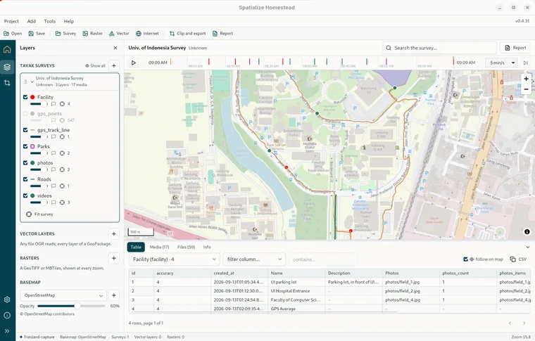
Homestead is one window with one map in it. Everything you open lands on that map, and everything you do happens on top of it. This page names the parts.
The menu bar and toolbar
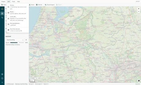
The menu bar is Homestead's own and is the same on every platform. Each item shows a short hint under its name. Esc closes an open menu; there are no keyboard accelerators.
| Menu | Items |
|---|---|
| Project | Open project… a .hstd file. Save project… what is open, how it shows, where the map looks. Settings. |
| Add | Survey… a Tavak backup (.zip); several can be open. Raster… GeoTIFF, MBTiles, JPEG 2000, VRT. Vector file… Shapefile or its zip, GeoJSON, KML, KMZ, GPX, CSV, GeoPackage. File Geodatabase… a .gdb folder. From the internet… a raster or a vector by URL. |
| Tools | Clip and export MBTiles, GeoTIFF, GeoPackage. Report… the survey as a PDF (greyed until a survey is open). |
| Help | About Homestead: the versions, the state of GDAL, and what the app is built from. |
The toolbar under it repeats those actions as buttons: Open, Save, Survey, Raster, Vector, Internet, Clip and export and Report. Narrow the window and the labels drop away, leaving the icons, with the label and the hint in the tooltip.
The rail
The dark strip down the left. Layers and Clip and export show or hide the panel beside the map, and clicking the active one again hides it. Settings and About open a page where the map was. The map stays loaded underneath, so nothing on it is lost, and clicking the page's button again brings it back. The last button collapses the rail to icons, or expands it to icons with labels, and remembers which you chose.
The panel beside the map
Only one panel shows at a time: either the Layers tree, which is what is on the map in drawing order, with the basemap chooser as its last section, or Clip and export. Drag the panel's right edge to resize it, and the close button in its header hides it. Adding a file opens the Layers panel if nothing was showing.
The map
Drag to pan, scroll or pinch to zoom, or use the + and − buttons at the top right. A scale bar sits at the bottom left, and while the cursor is over the map the longitude and latitude under it read just above that bar, in WGS 84 to five decimals. Clicking the map asks every visible layer what it has at that spot and opens the object panel on the right. See Looking things up.
With a survey open
A survey adds three things: a top bar over the map with the session's title, the surveyor, the search box and a Report button; the replay ribbon under it when the survey has dated rows (Replay); and a dock under the map with four tabs, Table, Media, Files and Info, and the current selection (layer and object id) beside them. Drag the dock's top edge to resize it; the arrow at its right collapses it to the tab strip.
The status bar
One line at the bottom, reading left to right: the project's name, or Untitled project, then Basemap, Surveys, Vector layers and Rasters, each with how many are shown. While an export runs it also carries Exporting MBTiles · phase · percent, since the export keeps going whichever panel you have open. The zoom level sits at the right end, with any map error in red beside it.
The keys that do something
| Key | Where |
|---|---|
| Esc | Closes an open menu, a dialog, the identify popover, the lightbox, the search list; leaves the drawing tool in Clip and export. |
| Enter | Starts the download in the address dialog; opens the highlighted search hit; opens a focused media card. |
| ↓ ↑ | Move through search hits. |
| ← → | Previous and next item in the lightbox. |