The PDF report
The survey as a document you can hand over: a summary of where, when, who and what, then one table per layer in capture order, with each row's photos and videos as thumbnails beside it. It is under Tools › Report…, or on the Report button in the survey's top bar.
Making it
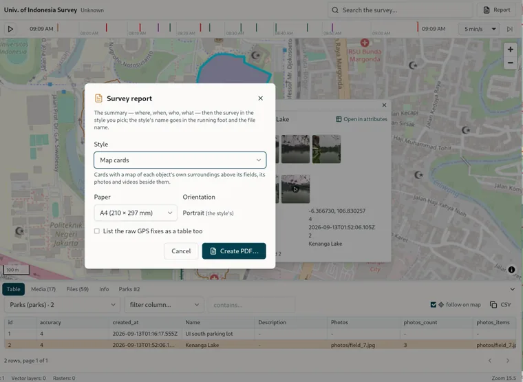
Choose the Survey if several are open, then the Paper, either A4, Legal or A3, and the Orientation. Landscape fits more columns. Tick List the raw GPS fixes as a table too to get the full track as rows, though be warned that it runs long. Create PDF… asks where to save it first, then builds the document with the progress showing in the dialog: reading the photos and videos, writing the summary, reading each layer, numbering the pages. When it finishes, the dialog gives the file's size and a Show in folder button. The paper and orientation it starts with come from Settings › Survey report.
What is in it
The header names the survey and the Homestead version that produced it. Then the summary block: Where, Coordinates, When, Exported, Who, GPS track, Archive and Description, followed by a table of the layers with their geometry and their object, photo and video counts, the other tables of the GeoPackage, and the datasets the backup carries. After that comes one section per layer, its rows in capture order, with a Photo and a Video column holding the thumbnails. A table too wide for the page is split by column instead of being cut off: the page's rows are repeated for each column part in turn, with the id carried through. Every page has a running head and a number.
The PDF's font covers the Latin alphabet and its Western European accents. Text in other scripts will not come out, so keep the report's layer and field names to those characters.