Settings and About
Project › Settings, or the rail. Settings are kept on this computer, and every survey and every tool follows them. The map stays loaded under the page.
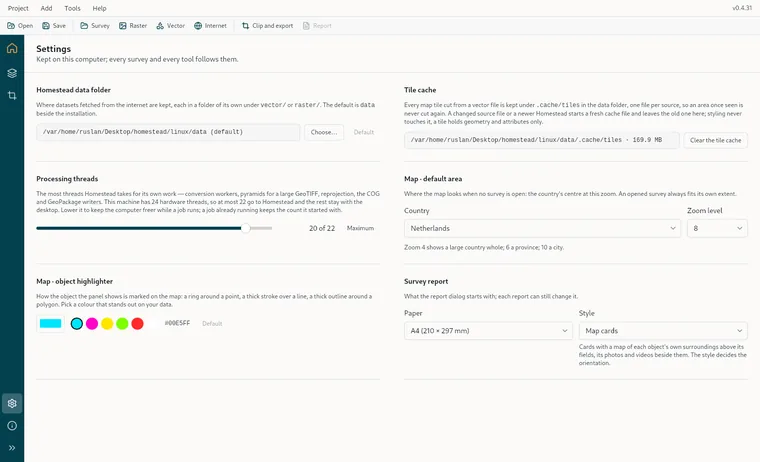
| Setting | What it does |
|---|---|
| Homestead data folder | Where datasets fetched from the internet are kept, each in a folder of its own under vector/ or raster/. By default that is data beside the installation, or beside the AppImage on Linux, falling back to the app's own data folder if that is not writable. Choose… points it elsewhere and Default puts it back. |
| Tile cache | Every map tile cut from a vector file is kept under .cache/tiles in the data folder, one file per source, so an area you have seen once is never cut again. If the source file changes, or you move to a newer Homestead, a fresh cache file is started and the old one left alone. Styling never touches the cache, because a tile holds nothing but geometry and attributes. The page shows the folder and its size, and Clear the tile cache empties it, after which any open layer cuts afresh. |
| Processing threads | The most threads Homestead will take for its own work: conversion workers, the pyramid of a large GeoTIFF, reprojection, and the COG and GeoPackage writers. The ceiling is the machine's hardware threads less one, or less two above eight, which keeps the rest of the desktop responsive. Lower it if you want the computer freer while a job runs. A job already under way keeps the count it started with. Maximum puts it back to the ceiling. |
| Map · default area | Where the map looks with no survey open: a Country, or the whole world, at a Zoom level. Zoom 4 takes in a large country, 6 a province, 10 a city. A survey you open always fits its own extent instead. |
| Map · object highlighter | How the object in the panel is marked on the map: a ring round a point, a thick stroke over a line, a thick outline round a polygon. Pick a colour that stands out against your own data. There are six presets and a colour well, and it starts on cyan. |
| Survey report | The Paper, A4, Legal or A3, and the Orientation that the report dialog starts on. Any individual report can still change them. |
About
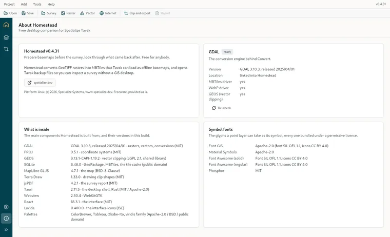
Help › About Homestead gives you the version and the platform. Then the GDAL card, with a ready or missing badge, the version, where it was found, which reads linked into Homestead for the bundled one, whether the MBTiles and WebP drivers and GEOS are present, and a Re-check button. What is inside lists the exact versions of GDAL, PROJ, GEOS, SQLite, MapLibre, Terra Draw, jsPDF, Tauri, the webview, React and the palettes. Last come the five symbol fonts with their licences. If GDAL is not working, the rail's About button carries a dot and the card tells you what to do about it.