Data Management
The Library tab holds everything that is not a survey: basemaps, rasters and vector datasets, geofences, landmarks and forms. There are four tabs, and all of them work the same way.
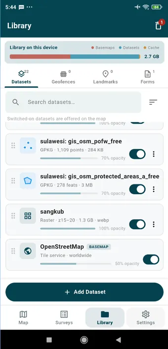
| Tab | Contains | Add with |
|---|---|---|
| Datasets | Online basemaps, rasters (MBTiles packs, GeoTIFF, GeoPDF) and vector data (GPX, GeoJSON, Shapefile, KML, GeoPackage, spreadsheets) | Add Dataset |
| Geofences | Circles, polygons and corridors, plus the monitoring switch | Add Geofence, Import |
| Landmarks | Global and session landmarks | Add Landmark, Import |
| Forms | Layer definitions you can reuse in a new survey | Add Form |
One way to work
- Tap a card for its options sheet: activate, show or hide, zoom to, change style, edit, delete. The header of the sheet tells you what you tapped and what state it is in.
- Swipe a card from right to left to delete it. You are asked to confirm first.
- The action bar at the bottom of each tab holds Add, along with Import, Download and Share wherever they make sense.
- Sort and filter, where they are offered, open as sheets from the top bar.
Trash
Deleted surveys, photos, videos and features go to the Trash, at the top right of the Library tab or under Settings › Storage, and you can restore them for 30 days. After that they are purged for you. Emptying the trash, or deleting a single item for good, frees its storage there and then. Geofences, landmarks and datasets are deleted outright once you confirm.
Storage
An imported basemap or layer is copied into the app’s own storage, so you can delete the original from the phone afterwards. Deleting the layer or basemap deletes that copy. Map tiles you view online are cached; Settings › Storage & Cache shows how big the cache has grown and clears it.