Import & Reference Layers
Reference layers are GIS data you bring in to sit under your survey: plot boundaries, road centrelines, a soil map, last year’s points. They are drawn on the map, you can tap them for their attributes, and they travel with a survey when you export it. What you cannot do is edit them in Tavak.
Supported formats
| Format | What is read | Limits |
|---|---|---|
| GPX | Waypoints, routes and tracks | 5 MB per file; per layer 5 000 polygons, 10 000 lines or 15 000 points |
| GeoJSON | Feature / FeatureCollection; Multi* members become separate features; polygon holes kept; properties become attributes | |
| Shapefile (.zip) | .shp/.shx/.dbf, and the .prj for projected data (UTM, TM-3, any EPSG or WKT) | |
| KML / KMZ | Placemarks including MultiGeometry; ExtendedData becomes attributes | |
| CSV / Excel (.xlsx) | A point layer from two coordinate columns; you pick the columns and the app validates every row | |
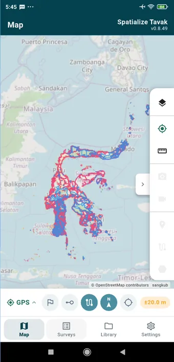
| GeoPackage (.gpkg) | Feature tables only, and you choose which of them become layers. Raster and tile tables are listed but greyed out. | 100 MB per file; the per-layer caps above; 30 000 features per import; 1 million vertices per layer |
| Vector Tiles (.mbtiles) | MVT/PBF tilesets, drawn from the tiles as you pan and zoom. See Basemaps & Offline Maps | No feature limit; storage only |
Importing a layer
- Open the Library tab, then Add Dataset › Vector Data.
- Tap Add Layer and pick the format.
- Choose the file. Tavak checks it there and then, so a wrong type, a file over the limit, or a shapefile ZIP with pieces missing is reported straight away rather than at the end of a long import.
- Give the layer a name and tap Import. A large file imports in the background with a progress bar, and you can cancel it.
A spreadsheet asks you which columns hold the latitude and longitude, and tells you how many rows it could not read before anything is imported. A GeoPackage shows you every table in the file, with its name, geometry type, feature count and coordinate system, and a checkbox beside each one it can import. Every table you tick becomes its own layer, named <file>: <table>.
Coordinate systems
Tavak stores everything in WGS 84. Data in a projected system is transformed on import:
- Shapefile: from the
.prj, so include it in the ZIP. Without it, projected coordinates, the ones with large metre values, are refused with a message rather than plotted somewhere wrong. - GeoPackage: from each table’s SRS. EPSG codes, UTM zones, Indonesian TM-3 and WKT definitions are all handled for you.
- When it cannot work out the system, a Coordinate System screen lets you search EPSG codes or pick a UTM zone, and it remembers what you chose last time.
Working with layers
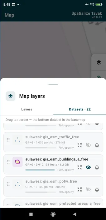
Tap a dataset card in Library › Datasets for its options: show or hide it, zoom to its extent, change its style, or delete it. Swiping a card from right to left also deletes it.
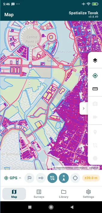
Style sets the colour, the line width, the fill and the point symbol. A large layer is simplified at low zoom levels so that panning stays smooth, and the full geometry comes back as you zoom in.
Tapping a reference feature on the map opens its attributes. Where several objects overlap, you get a list to pick the one you meant.
Layers and survey export
Any reference layer that was visible during a survey goes into its export bundle, so the survey opens in QGIS with the same context around it. Layers that came from one GeoPackage share a single copy of the file in the bundle. Deleting a layer removes its file from the device once nothing else is using it.
Re-importing a survey
A survey exported from Tavak, as a ZIP or a GeoPackage, can be imported onto another device from the Survey tab. The importer checks the bundle’s metadata, puts the session back together with its track, media, features, forms, destinations and reference layers, and tells you about anything it had to skip. Landmarks in the bundle that the device already has are not duplicated.
When it doesn’t work
- “Coordinates are not latitude/longitude”
- The shapefile is projected and the ZIP has no
.prj. Add it and import again. - The layer imported but nothing shows on the map
- Zoom to its extent from the layer options; it may just be somewhere else entirely. If it turns out to be empty, the file’s geometries could not be read. A GeoPackage with curved geometry, for instance, is refused table by table, with the reason shown in the picker.
- Import refused as too large
- Split the file, or simplify it in QGIS first. The limits are there so that the map stays usable on a phone.